Stony Clove Stream Management Plan
 Since 1995, the New York City Department of Environmental Protection Stream Management Program has made a commitment to provide technical and financial assistance to communities for stream management planning and implementation. Working with the local Soil & Water Conservation Districts, as well as watershed stakeholders, the NYCDEP has promoted the use of watershed level stream assessments to develop stream restoration and protection strategies.
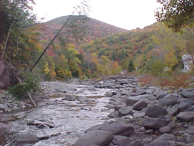
The Stony Clove Creek is located in the center of the Catskill region. Ringed by Sheridan, Little Rocky, Tremper, Carl, Olderbark, Plateau, Hunter and Westkill mountains, the Stony Clove Creek is typical of mountain streams. These stream often experience problems with flooding, water quality, recreation and human activities. Steep slopes, poorly drained soils, glacial geology and rainfall patterns are but a few of the factors which impact the Stony Clove.
The Greene County Soil & Water Conservation District and New York City Department of Environmental Protection worked with the Towns of Hunter and Shandaken, the NYS Department of Environmental Conservation, Ulster County Soil & Water Conservation District and other partners to develop a long term, multiple objective management plan for Stony Clove Creek. This plan documents current and historical conditions in the stream and offers recommendations for improving the Stony Clove's stability, fisheries, and water quality, as well as reducing flood damage. This project was made possible through funding from the NYC DEP Stream Management Program, the US Army Corps of Engineers under the Watershed Environmental Assistance Program, and NYS Department of Environmental Conservation.
Volumes I and II of the Stony Clove Creek Stream Management Plan (SMP) were released in 2005. Volume I provides Stony Clove Creek background information, watershed resources and institutional information. Volume II provides individual Management Unit Descriptions and General Recommendations, specifically tailored to the ongoing stewardship of the Stony Clove Creek sub-basin, as well as a description of the demonstration restoration project in Lanesville, and suggestions for plan implementation.
Volume 1
Table of Contents, Preface and Acknowledgements
Introduction & Goals
Stony Clove Natural and Institutional Resources
This section provides watershed background information and characteristics which influence the Stony Clove. A chapter on living streamside and stream related activities may be of particular interest to landowners, answering commonly asked questions, including necessary permits and agency contacts, relating to activities which may impact stream health or stability.
Regional Setting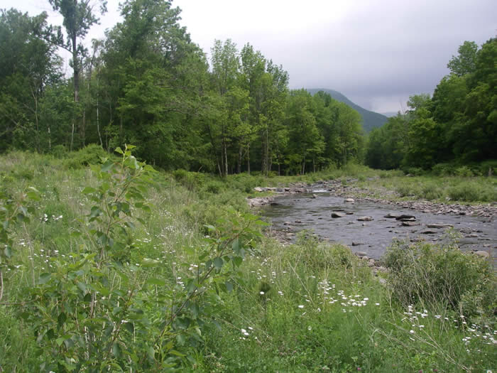
Physiography
Hydrology and Flood History
Watershed Geology
Wetlands & Floodplains
Riparian Vegetation
Landuse/Landcover
Stakeholders
Recreational Opportunities
Agency Contacts and Program Resources
Stream Related Activities and Permit Requirements
Watershed Inventory and Assessment
This section includes a summary of water quality assessments that have been undertaken over the years in the Stony Clove, an introduction to the science of stream processes, and a description of the watershed assessment protocol used to develop this stream management plan.
Water Quality Assessment
Introduction to Stream Processes
Watershed Inventory & Assessment
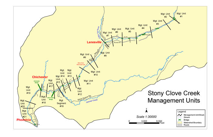
Section 4 - Management Unit Descriptions
This section contains very detailed descriptions and specific recommendations for the Stony Clove, from the headwaters at the top of the watershed, downstream to its confluence with the Esopus Creek, located in the Town of Shandaken. The Stony Clove has been organized into 21 Management Units (MUs), defined using physical stream characteristics, historical channel alignments, location of bridges and road infrastructure, and valley characteristics. These MU descriptions outline stream conditions (its bed and banks), general streamside (riparian) vegetation condition, and proximity and arrangement of roads, bridges and culverts.
Management Unit Map
Section 5 - Demonstration Projects
Lanesville Stream Restoration Project Report
Section 6 - General Recommendations
This section sets forth an extensive list of recommendations related to education and outreach, flood protection, water quality, public enjoyment, fisheries, riparian zone management, stream management, and programmatic issues, providing a frame work for watershed stakeholders to develop a long term management strategy to protect and improve the Stony Clove.
General Recommendations
Plan Implementation
Appendices
Appendix A - Riparian Vegetation Analysis for the Streamside Planting Program
Appendix B - Fish Habitat Assessment on Stony Clove Creek, NY using MesoHABSIM
Appendix C - Native Trees, Shrubs and Ground Covers for Riparian Buffers
Appendix D - Watershed Data and Analysis
Glossary
Additional Information
Historic Photos of the Stony Clove
Stony Clove Stream Management Plan Project Team
Cornell Cooperative Extension of Ulster County
6375 Rt. 28, Shandaken, NY 12454
Phone - 845.688.3047; Fax 845.688.3130
Elizabeth Higgins, Project Coordinator
emh56@cornell.edu |
NYCDEP Stream Management Program
71 Smith Ave, Kingston NY 124021
Phone (845) 340-7839 Fax (845) 338-1367
Dan Davis, Project Manager
ddavis@dep.nyc.gov |
Greene County Soil & Water Conservation District 907 County Office Building, Cairo NY 12514 Phone (518) 622-3620 Fax (518) 622-0344
Abbe Martin, Project Manager
abbe@gcswcd.com |
|
|