| |
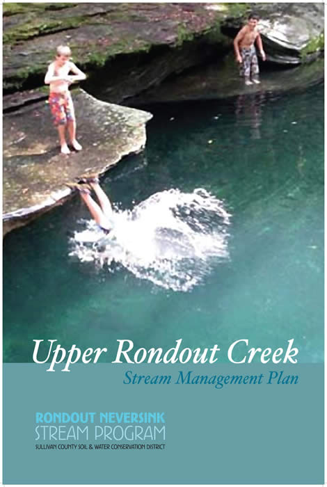 |
UPPER RONDOUT CREEK STREAM MANAGEMENT PLAN
The community process for local stream management planning is an emerging practice in the Catskills region that recognizes the stream's importance to our overall quality of life. The purpose is to coordinate decision-making around common goals we collectively identify for the stream. This stream management plan was created cooperatively by bringing together the Rondout watershed community, local leaders and area agency representatives, and identifies many common goals for the Rondout Creek and its adjacent floodplains, forests and wetlands.
Complete Stream Management Plan
|
| |
|
SURVEY REPORT
Opinions and Interests Concerning Stream Management Expressed By Streamside Landowners in the Upper Rondout and the East and West Branches of the Neversink River, November 24, 2009
Complete Report
|
| |
 |
The following pages strive to evoke a community feeling and
stream stewardship ethic among Catskill Mountain residents.
This booklet for streamside landowners provides helpful
information about ways to live in harmony with Catskill
streams and the beautiful landscape they support. ...
(more) (Individual Pages - Higher Resolution)
Complete Guide(3 MB)
|
| |
 |
This report lays out the significant challenges New York faces as it attempts to reshape the laws, regulations and policies that regulate drinking water and maintain healthy rivers. Several case studies in the report demonstrate these challenges in different regions of the state. The final section of the report offers a set of recommendations for improving river health and management of New York’s water supplies.
Complete Report (1.9 MB)
|
| |
 |
Conserving Natural Areas and Wildlife in Your Community: Smart Growth Strategies for Protecting the Biological Diversity of New York's Hudson River Valley.
Conserving Natural Areas and Wildlife in Your Community is a guide for anyone involved or interested in biodiversity conservation and local land use planning and decision-making, including elected officials, volunteer board members, and interested citizens and organizations. It describes how to find biological information about your community and the tools and techniques that local governments can use to conserve natural areas and wildlife.
Link to Guide (NYSDEC Website)
|
| |
 |
Upper Esopus Creek Management Plan: Summary of Findings and Recommendations
People and Catskill Mountain streams have had to adjust to each other for several centuries.We live with the beauty of streams while also learning to live with their powerful forces as they convey water and sediment out of the watershed. The streams that have helped carve these mountain valleys have adjusted their form to natural influences such as the regional climate, geology and ecosystem. Human development on the watershed landscape - roads, bridges, houses, and towns - are another influence on the stream’s adjustment to its setting. Likewise, people adjust to the influences of the streams they live along. To sustain viable communities, we need to plan for the natural erosive and flooding forces that come with the steep slopes, melting snow and torrential rains common to the Catskills.
Complete Report (3.3 MB)
|
| |
Guide to Stream Friendly Practices for Common Streamside Projects |
Do you have a streamside issue created by erosion or stormwater runoff? Are you considering building a house or structure near a stream, landscaping your streamside area, or adding a road or walkway on your property?
Cornell Cooperative Extension of Ulster County's Stream Management Program staff have developed a new guide for stream side landowners "Guide to Stream Friendly Practices for Common Streamside Projects" In this guide we have answered some frequently asked questions from local homeowners about streamside projects.
For more information about this guide, contact Michael Courtney (845) 688-3047 or by e-mail at mcc55@cornell.edu.
Link to Guide (294 KB)
|
| |
Wetlands in the Watersheds
of the New York City
Water Supply System |
This booklet is the first revision of the 1996 National Wetlands Inventory (NWI) report,
and is based on the findings of the updated NWI. This
booklet also describes wetland landscape settings and provides estimates of wetland gains, losses, and cover type changes as determined through additional joint USFWS-DEP wetland mapping projects in the New York City Watershed. A general overview of the characteristics and functions of wetlands is also provided, along with information on wetland protection and stewardship.
Link to Booklet (2.8 MB)
|
| |
 |
Catskill Streams Buffer Initiative (CSBI) Brochure - The CSBI was created through a collaborative effort of local nonprofits and environmental organizations to fill a gap for streamside property owners. While other programs are available to owners of larger streamside parcels used for forestry or farming, no similar resource existed for smaller parcels. CSBI provides residential landowners along stream banks in the Catskill/Delaware watershed a reliable resource for individualized assistance and financial support to help you protect property from damage and ensure a healthy, stable riparian area.
Link to Brochure (672 kb)
|
| |
|
|